


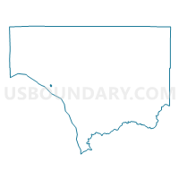
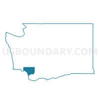
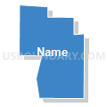
Hemlock Voting District, Cowlitz County, Washington
About
Outline

Summary
| Unique Area Identifier | 684034 |
| Name | Hemlock Voting District |
| County | Cowlitz County |
| State | Washington |
| Area (square miles) | 0.14 |
| Land Area (square miles) | 0.14 |
| Water Area (square miles) | 0.00 |
| % of Land Area | 100.00 |
| % of Water Area | 0.00 |
| Latitude of the Internal Point | 46.13840770 |
| Longtitude of the Internal Point | -122.96586520 |
Maps

Graphs
Select a template below for downloading or customizing gragh for Hemlock Voting District, Cowlitz County, Washington


Neighbors
Neighoring Voting District (by Name) Neighboring Voting District on the Map
- Fir Voting District, Cowlitz County, WA
- Lake Voting District, Cowlitz County, WA
- Maple Voting District, Cowlitz County, WA